Apps to Help You Succeed!
Hey there, fellow REALTORS®!
Are you tired of juggling tons of paperwork and struggling to keep track of all your property details? Wish you had an easier way to access property data and boundaries, all in one place?
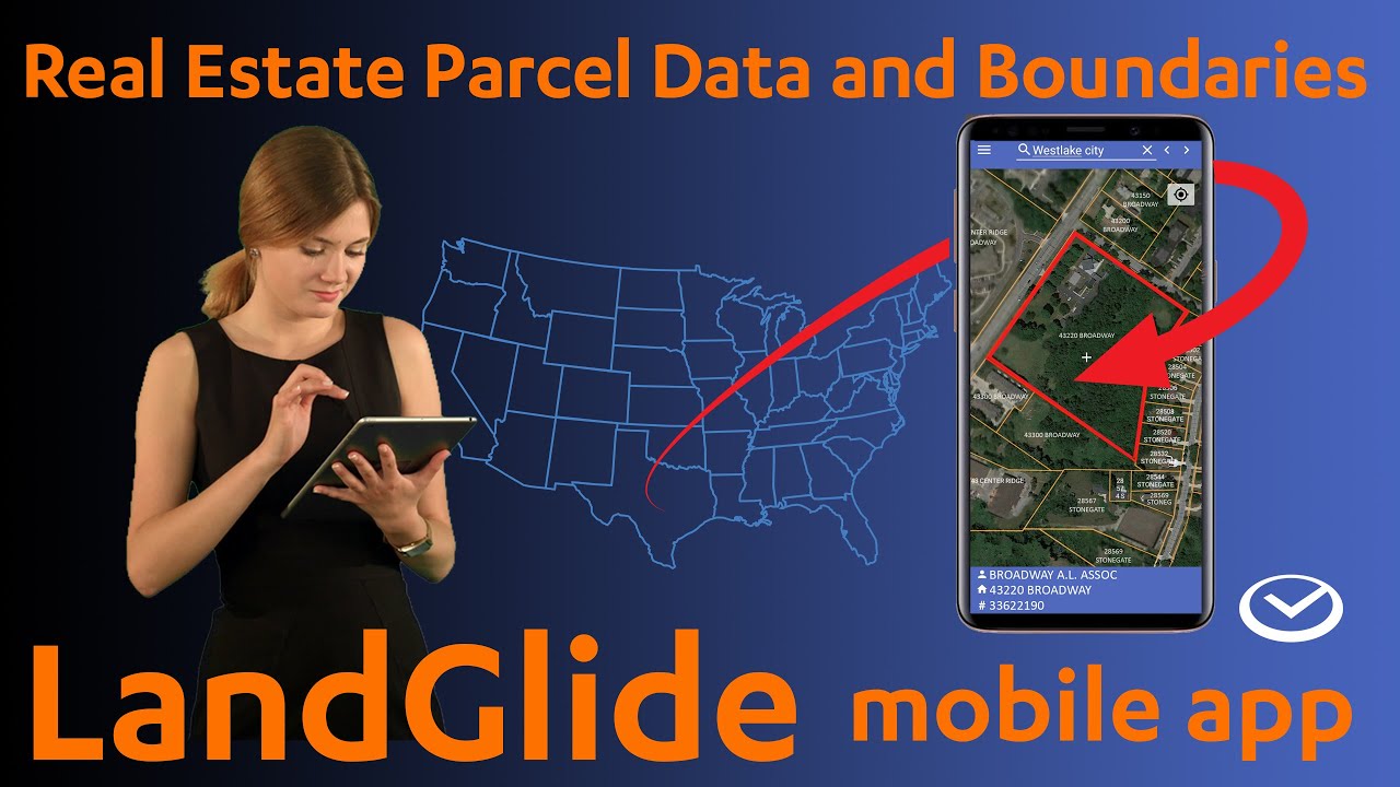
Well, fret no more! LandGlide is here to revolutionize the way you work. LandGlide is a super user-friendly GPS property line map application that puts a wealth of property information at your fingertips.
Here's how LandGlide can supercharge your real estate business:
- See it all at a glance: LandGlide provides clear, easy-to-read maps that show you property boundaries. Simply hover over a property to view details like square footage, acreage, and even the owner's mailing address!
- Never get lost in the details: LandGlide lets you save your favorite properties and add your own notes, making it easy to keep track of everything you need to know.
- Work offline, no sweat: LandGlide doesn't require an internet connection to access property data. This means you can keep working even when you're out in the field, showing properties to clients.
- LIVE VIEW: When you are visiting a property, LandGlide shows your real time location LIVE on the app. As you walk the property, you can get a good idea of the RELATIVE property lines.
Is LandGlide right for you?
While LandGlide is a fantastic tool that can save you time and hassle, we understand that many REALTORS® are working on a tight budget. Here's the good news: LandGlide offers a free 7-day trial, so you can try it out for yourself and see if it makes a difference in your business.
In my honest opinion, LandGlide is absolutely worth the expense. It's a real game-changer that can help you streamline your workflow, impress your clients, and close more deals.
Ready to take your real estate business to the next level? Sign up for your free trial of LandGlide today!
P.S. Don't worry if you're not super tech-savvy. LandGlide is designed to be easy to use for everyone.
P.P.S. LandGlide is not to be considered a replacement for a property survey. LandGlide uses the GPS information it gathers from your cell phone. LandGlide states, “A recent worldwide study found that GPS-enabled smartphones show positional accuracy within a 4.9 m (16 ft.) radius under open sky conditions. However, the accuracy degrades near structures and tree canopies. Urban areas on average, have more GPS signal bounce, and smartphones can detect satellite signals from a much smaller portion of visible sky.”


